Forest Itinerary – Exploring the Oriented Nature Reserve
Nature and cultural itinerary. Following the path leading into the woods, you climb up to Ustica's highest hill: Guardia Grande (244m).
Symbol
Yellow Square
Distance
5 Km
Elevation difference
180 mt
Width
From 1 meter to 2 meters
Trail bottom conditions
Suitable for
Adults Children and teenagers Families
Description
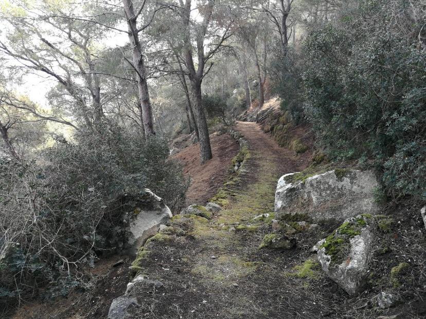
Nature and Culture Itinerary. Following the trail leading into the woods, you’ll climb Ustica’s highest hill, called Guardia Grande, standing at 244 meters. Starting from the town hall, walk along Via Tre Mulini, which crosses the historic center before entering the grove nestled within the Oriented Nature Reserve, where you’ll access the trail beginning with steps ascending the hill.
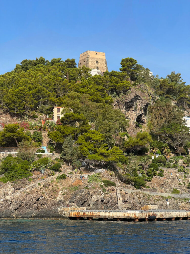
After about 500 meters, you’ll encounter a lava channel that tells the story of the island’s first volcano emerging from the sea. Later, you’ll visit the oldest necropolis discovered on Ustica: the “Culunnedda,” dating back to the 3rd–2nd millennium BC. After one final uphill stretch, you’ll reach the hill’s summit. Here, you’ll find a fenced-off area belonging to the military air force, housing a weather station, followed by a heliport primarily used for air rescue—and the most prominent structure at the top, with its large white dome covering it: the aircraft radar, a reminder of the history tied to the Ustica massacre.
From here, the descent begins. After about 300 meters, you can take a small unpaved detour to the left, connecting to the neighboring hill called Guardia dei Turchi. Continuing downhill, you’ll reach the Sunset Trail. At the fork, turning left (recommended) leads you out after a kilometer near the Madonna della Croce chapel, or turning right takes you back to the village. The entire route lies within Zone A of Ustica’s Oriented Nature Reserve.
Highlights
Climbing up the steps, you’ll pass through rocky crevices and maritime pines until you encounter, after about twenty minutes of ascent, on the left, a lava tunnel hidden by vegetation: the Grotta del passo di Don Bartolo. The lava channel can be reached by continuing off the main trail southward for a few dozen meters.
The underground conduit likely extends several kilometers toward the sea, and it’s not far-fetched to hypothesize that it may be the origin of the Grotta Azzurra formation, located about three kilometers from here.
Still on the left, a few dozen meters further ahead at a place called Culunedda or Culunnella (238 m above sea level), there’s another detour leading to four hypogeum tombs dating back to the Ancient Bronze Age (3rd-2nd millennium BC). In this area, you might spot the Argiope lobata, a non-venomous spider not yet documented in the terrestrial reserve.
Returning to the main path and continuing westward, you reach the summit of Middle Hill (also called Middle Guard or Great Guard), the highest point on the island at 244 meters above sea level. Here stands one of Italy’s most powerful radars, built after the infamous Ustica massacre on June 27, 1980. Next to it is a large area with a helipad primarily used for air rescue operations. Adjacent to the radar, a paramilitary weather station operates, equipped with instruments like an anemometer, rain gauge, hygrometer, barometer, thermometer, and weather vane. These tools provide crucial data, helping local residents anticipate weather conditions and prepare accordingly. Following the fence around these two facilities leads down the opposite slope of the hill.
The southern path intersects, after a few hundred meters, with an asphalt road connected to the municipal road, or from the northern side, a descent that will lead to a left turn, where in both cases you ascend the hill on the side named Guardia dei Turchi (238 meters) properly speaking. This latter was the summit, overlooking the less frequented part of the island, where, presumably, the lookout post for spotting pirates was located. The true Monte Guardia dei Turchi is also called Costa del Fallo due to its steep slopes, and Monte del Cavaliere because of its shape; while what current maps label as Monte Guardia dei Turchi is actually the combination of Cima Culunnedda with the summit Guardia di Mezzo.
The processes leading to the evolution of place names are tied to changes in land use and the fading memory of the reasons behind their original naming. In this specific case, it is preferable to retain the older place names—partly because they have been simplified and relocated rather than transformed, and partly because their original forms better illustrate their defensive function against pirates.
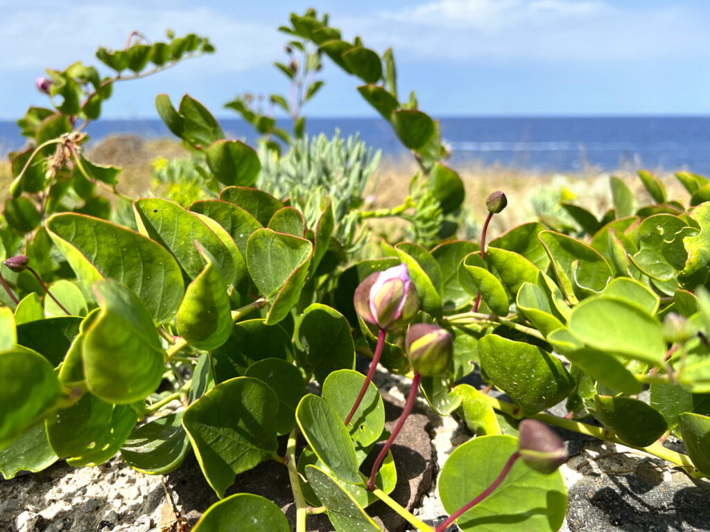
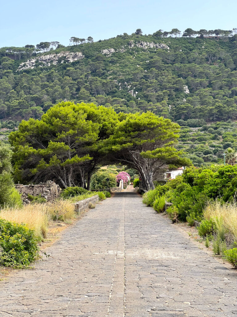
The elevations of Ustica are what erosion has not yet dismantled of volcanic structures active until approximately 420,000 years ago. In various parts of the island, holes emitting warm, humid air—called vuccaroli or fumaroles—have been documented. However, this phenomenon is believed to have little to do with volcanism and is instead linked to geothermal activity. The natural vegetation is a garrigue with patches of maquis, dominated by the characteristic Lentisco (Pistacia lentiscus), which grows low to the ground. Some introduced species, such as the artificial pine forest (of Pinus halepensis) and eucalyptus, adopt a similar low-growing form near the coast.
Climbing to the top of this hill, you’ll notice several telecommunications antennas, but once you pass through the gate installed by the Sicilian regional forestry service, a charming path lined with pine trees and carpeted with their needles reveals itself. A true natural spectacle at the summit of the island’s second-highest hill. From here, you can admire panoramic views spanning the southwest coast—featuring the Punta Cavazzi lighthouse and the Spalmatore tower—then shifting westward to Cala Sidoti and the Scoglio del Medico, before turning north to see Punticedda and the Faraglioni, and finally eastward, where the solitary Falconiera hill, the island’s last and lowest, dominates the view.
Turning instead to the right side and following the path that leads back into the woods, after crossing a fissure between walls of volcanic lapilli and continuing downhill, you’ll encounter two caves used for extracting the same volcanic material. These quarries were utilized to obtain the fundamental component of a unique building cladding that dates back to the Bourbon period. Today, due to numerous collapses, they have been closed to the public. After walking about two kilometers, we reach the final stretch of this trail, which leads back to the original cobblestone path we encountered earlier – the Sunset Trail.
This last section, passing through areas of Mediterranean scrubland – dense spontaneous vegetation like mastic trees, mock privet, alaternus, wormwood, brooms, spurges, and trees such as ash, pine, oak, holm oak, downy oak, strawberry trees, and eucalyptus – also offers a broad panorama of the well-cultivated lands of the Tramontana plain.
From this point along the route, we come to a fork where turning left leads to two large dark walls joined at a right angle, tall and well-shaped—remnants of a tuff quarry used from ancient times until the mid-20th century to extract small blocks for building houses. This particular dark tuff results from the sedimentation of ash released by the island’s volcanoes, layered and compacted over centuries. Each eruption deposited a thin layer of material composed of heavier lapilli and lighter ash. By counting the different stratification lines and analyzing their granulometric and sedimentological characteristics, it’s possible to determine the frequency and type of volcanic explosions that occurred over time.
In some places, the clear horizontality of the deposits has been disrupted by the presence of rocky elements embedded within the various layers. These are rock formations commonly called “lava bombs”—fragments of highly viscous lava forcefully ejected by volcanic explosions and solidified upon cooling before hitting the ground. These semi-consolidated rocks deformed the softer ash layers with their weight, visibly altering the depositional pattern, as can be clearly seen.
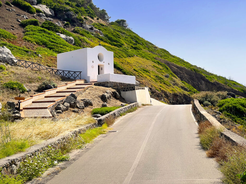
Dopo un centinaio di metri il percorso trova un ulteriore bivio: da una parte si procede in linea retta attraverso un cancelletto che immette nel bosco mentre dall’altra si scende verso la strada comunale nei pressi del Passo della Madonna. Qui, alla fine del viottolo, s’incontra la cappelletta della Madonnina della Croce; la struttura sacra ospita una piccola statua in legno rappresentante la Pietà con alle spalle la croce. La statuetta policroma è alta non più di quaranta centimetri. La Vergine Maria viene festeggiata dagli usticesi la prima domenica di settembre; per l’occasione una processione muove dalla chiesa cittadina fino a giungere al piccolo santuario
ubicato in prossimità del Passo della Madonna percorrendo tutta la strada di Tramontana. Il lento incedere dei fedeli è accompagnato dai fuochi delle Vamparine, piccoli roghi appiccati dai contadini locali e realizzati bruciando alti mucchi di sterpaglia in onore della Vergine. Il percorso che invece procede nell’altra direzione si inserisce per un centinaio di metri dentro il boschetto in un cammino tappezzato di aghi di pino e costeggiato da alberi e viottoli curati dalla forestale.
Recommended clothing
Hiking boots, comfortable athletic clothing, a water bottle, and a cap.
Important Notes
It rejoins from the entrance of the Sunset Trail
Itinerary Data
Recommended Period
from May to Octoberf
Time: From 5:30 PM to 8:00 PM