Southern Itinerary – Between Relaxation and Health
The trail runs along the entire southern coast of the island, offering constant views of the shoreline and sea on one side, while flanked by dense vegetation dominated by maritime pines and Mediterranean scrub on the other.
Symbol
Little Red Square
Distance
5,5 km
Elevation difference
40 meters. Bearable
Width
irregular strokes between 3.00 meters and 0.70 meters.
Trail bottom conditions
Suitable for
Adults Children and teenagers Families
Description
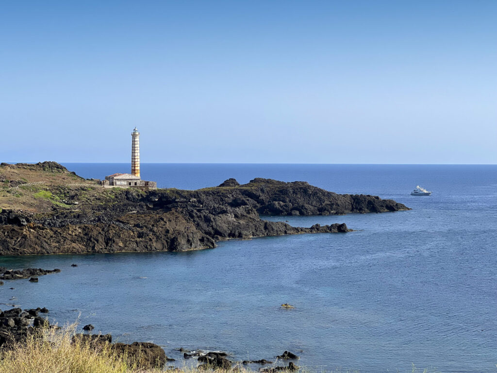
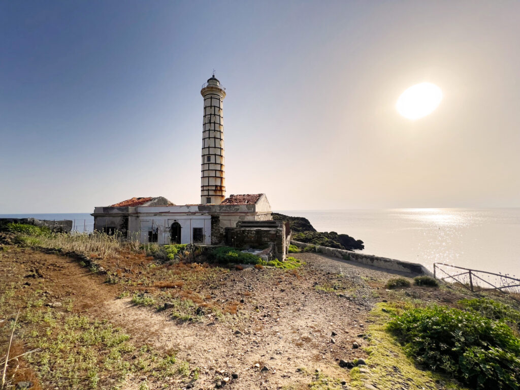
A nature trail starting from Punta Cavazzi in the southwest of the island, or alternatively it can be done in reverse from the southeast side, either from Punta S. Ferlicchio or from Torre S. Maria. The route is quite fascinating as it crosses the entire southern coast of the island, offering constant views of the coastline and sea on one side while revealing dense Mediterranean flora dominated by maritime pines and scrubland on the other. Along the way, you’ll be able to identify various types of flora as well as the locations of sea-accessible caves, some of which can also be reached from land. The coastline features ruins of old watchtowers once used for spotting enemies. The final stretch—when starting from S. Ferlicchio—ends beautifully at Punta Cavazzi, where we find the second lighthouse and a natural swimming pool.
Highlights
Starting from Punta Cavazzi, after a few hundred meters the route passes by two very important adjacent structures for the island: the desalination plant and the waste storage center.
The desalination plant, built in 1995 and activated only in 2001, is located at the top of an 85-meter-high hill in the Arso district.
Saltwater is drawn from an intake positioned on the seabed (at a safe distance from the ecosystem’s organisms) and passes through a grid that keeps macroscopic solid objects out of the pipeline; it then reaches the lifting pumps and is pushed up to the desalinator. Originally, desalination was achieved through distillation—evaporating saltwater by applying heat and then recondensing it in the white tank via refrigeration. Today, however, it operates via reverse osmosis, where water is stripped of all its minerals (especially salts), leaving only H2O, before being supplemented with the appropriate minerals and transformed into drinking water supplied to all local households. The output of water available to residents is about 70% of what is drawn from the sea; with an input pressure of 4 bar, 90 m³/h can be extracted, with roughly 66 m³/h made potable. As one can easily imagine, this is a highly important facility for the island of Ustica, as there are no alternative water sources beyond the desalination plant, especially considering that until 26 years ago, water only arrived via tanker ships, which also incurred high costs.
Equally important is the nearby structure—the waste storage center, an excellent facility dedicated to sorting urban solid waste, an initiative that began tentatively in Ustica in 2011 and gained momentum from 2013 onward. Today, waste sorting is a well-established practice that helps make our island greener and fosters effective environmental awareness.
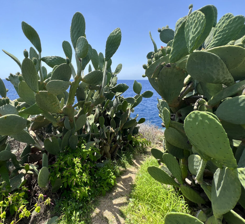
After passing the storage center, the path winds through Mediterranean scrub and maritime pines; capers and prickly pear plants stand out, and it’s not uncommon to hear rustling from the movement of Podarcis sicula (the Italian wall lizard).
The trail proves highly varied—transitioning from packed earth to rock, descent to ascent, flatland to steps, and open spaces to rocky crevices.
The eye delights in the splendid coastal panorama: the succession of Punta dell’Arpa, Scoglio del Cornuto, Punta Galera, coves with colorful seabeds, and the passage past five caves along this slope make every step unique. Near the village, close to an ancient windmill (now blade-less and once used for grinding wheat), the route offers a choice: descend toward the cliffs or continue toward the Santa Maria tower.
In the first case, you might come across a well-kept patch of land equipped with benches where you can sit and admire the view, perhaps with a good book left by travelers in the designated box.
After such a comforting break, you can continue until you reach the southern side of the village, passing through the Mediterranean scrub near the Grotta Azzurra hotel.
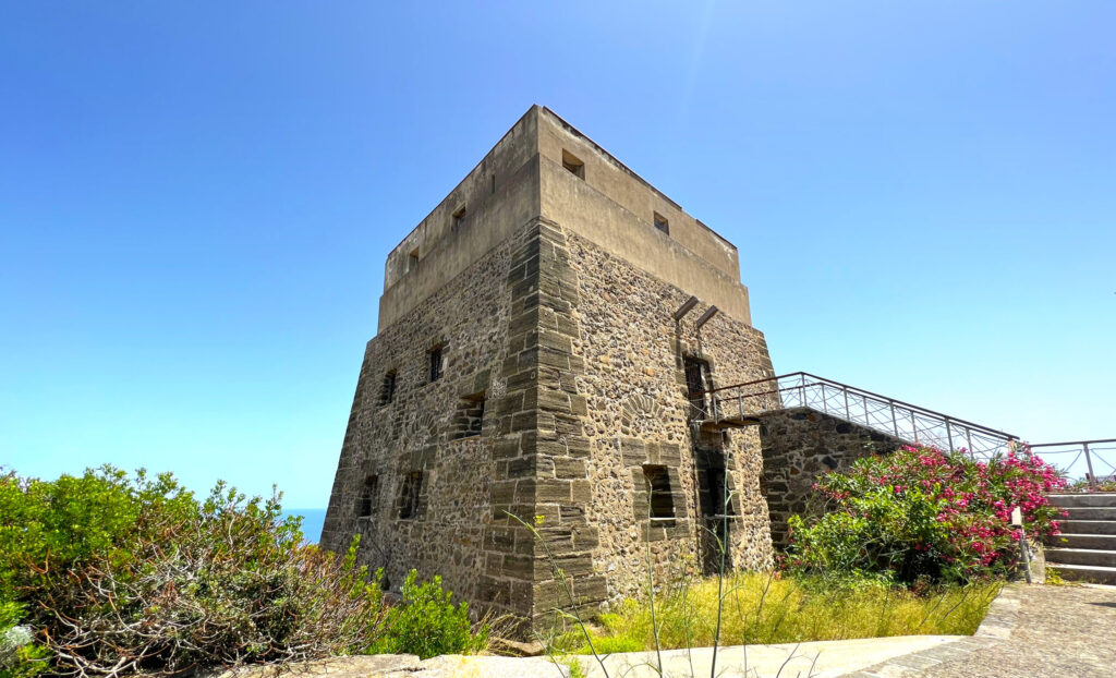
If you decide to head straight to the village, you can take the small road next to the sports fields that leads to the Bourbon Tower of Santa Maria, built in 1763. It was originally used as a defensive outpost, then as a detention site during the fascist era, and since the 1970s it has been repurposed as a Civic Museum and Art Gallery. From the tower, you can admire the village below and the small cove of the same name. Descending the staircase in front of it quickly brings you right into the town center.
Recommended clothing
hiking boots, comfortable athletic clothing, long pants, a water bottle, and a cap.
Important Notes
Walking stick trail. It can be done in both directions.
Itinerary Data
Recommended Period
from May to October
Time: From 4:00 PM to 6:00 PM